
D'Aguilar, Queensland
| D'Aguilar Queensland | |||||||||||||||
|---|---|---|---|---|---|---|---|---|---|---|---|---|---|---|---|
 D'Aguilar Hotel | |||||||||||||||
 D'Aguilar | |||||||||||||||
 | |||||||||||||||
| Coordinates | 26°59′23″S 152°48′00″E / 26.9897°S 152.8°E | ||||||||||||||
| Population | 1,474 (2021 census) | ||||||||||||||
| • Density | 147.4/km2 (381.8/sq mi) | ||||||||||||||
| Postcode(s) | 4514 | ||||||||||||||
| Area | 10.0 km2 (3.9 sq mi) | ||||||||||||||
| Time zone | AEST (UTC+10:00) | ||||||||||||||
| Location |
| ||||||||||||||
| LGA(s) | City of Moreton Bay | ||||||||||||||
| State electorate(s) | Glass House | ||||||||||||||
| Federal division(s) | Longman | ||||||||||||||
| |||||||||||||||
D'Aguilar is a rural town and locality in the City of Moreton Bay, Queensland, Australia.[1][2] It is located northwest of the larger centre of Caboolture. In the 2021 census, the locality of D'Aguilar had a population of 1,474 people,[3] while the town of D'Aguilar had a population of 1,341 people.[4]
Geography[edit]
D'Aguilar lies on the D'Aguilar Highway between Wamuran and Woodford. It is also the northern endpoint of Brisbane–Woodford Road (Mount Mee Road), which leads south through Delaneys Creek and Mount Mee to Dayboro. A small section of the Beerburrum West State Forest is in D'Aguilar.[5]
History[edit]
The town is named for Major General Sir George D'Aguilar, a military officer who wrote Regulations and Punishments of the British Army, the army textbook in use at the time of the town's establishment.[6] As time passed, the mountain range that the town is situated in came to be named after the town.
Demographics[edit]
In the 2021 census, the locality of D'Aguilar had a population of 1,474 people with a median age of 36 and weekly income of $1,896.,[3] The town of D'Aguilar had a population of 1,341 people.[4]
References[edit]
- ^ "D'Aguilar – town in Moreton Bay Region (entry 9157)". Queensland Place Names. Queensland Government. Retrieved 20 July 2021.
- ^ "D'Aguilar – locality in Moreton Bay Region (entry 49226)". Queensland Place Names. Queensland Government. Retrieved 20 July 2021.
- ^ a b Australian Bureau of Statistics (28 June 2022). "D'Aguilar (SAL)". 2021 Census QuickStats. Retrieved 31 May 2024.
- ^ a b Australian Bureau of Statistics (28 June 2022). "D'Aguilar (UCL)". 2021 Census QuickStats. Retrieved 31 May 2024.
- ^ Google (17 January 2023). "D'Aguilar" (Map). Google Maps. Google. Retrieved 17 January 2023.
- ^ "Caboolture Town History". Archived from the original on 28 May 2008. Retrieved 6 May 2008.
External links[edit]
- "D'Aguilar". Queensland Places. University of Queensland.
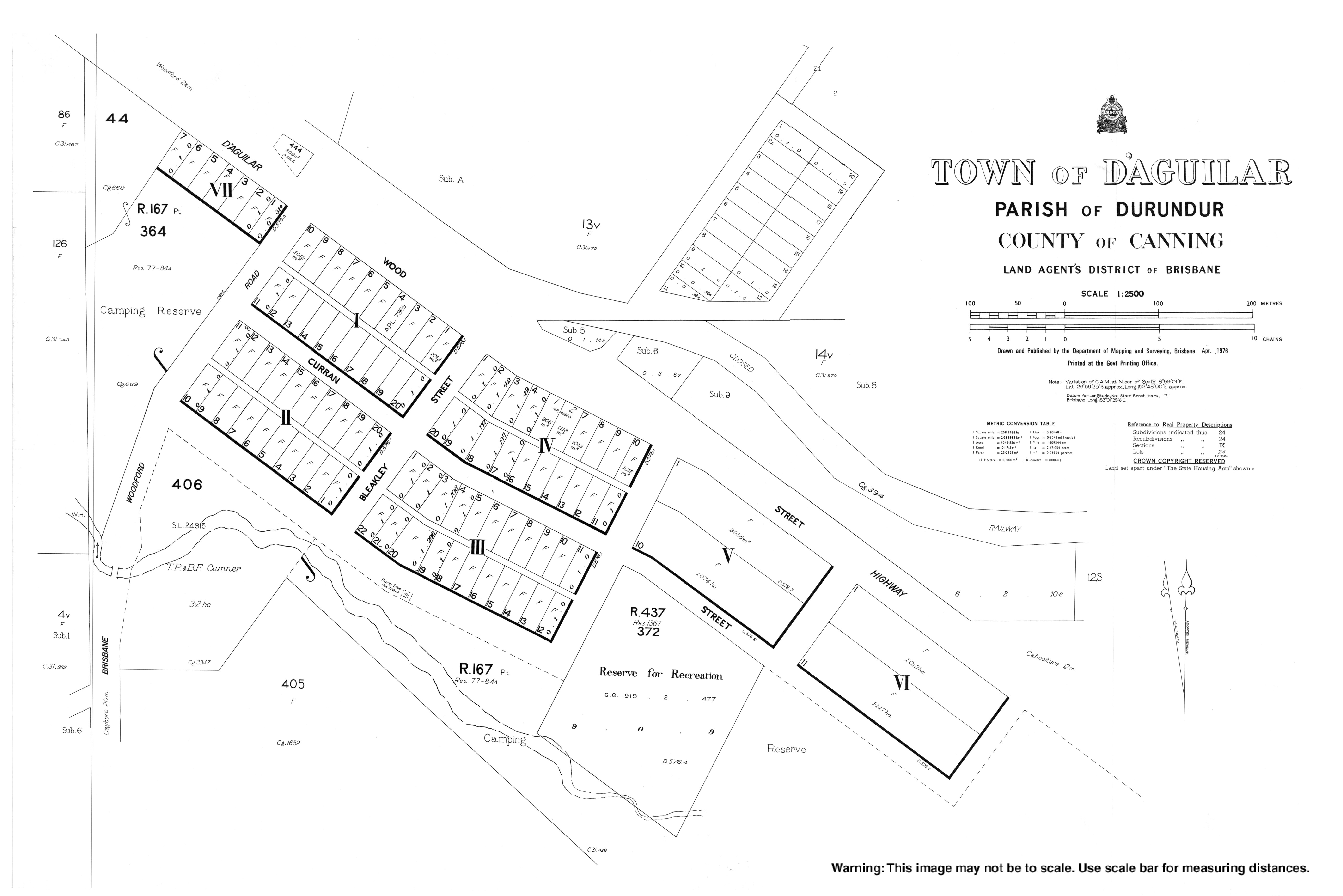
- "Town map of D'Aguilar". Queensland Government. 1976.